Wardle
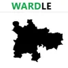
Wardle guides participants across lands, counties, and administrative boundaries of the United Kingdom. Within this experience, you face a curious map silhouette. Your mission involves decoding it within just six guessing turns. Every time users submit a flawed prediction, systems will not abandon you; instead, they supply extremely valuable directional clues. These hints encompass geographic distances measured from your guess to target spots, compass directions required for travel there, and percentage metrics indicating proximity levels. Individuals will narrow search scopes following every attempt to uncover precise answers before running out of six turns. You can etch your name on the golden roll of brilliant geographers.
DETAILED GAMEPLAY
In the center of the screens lies border imagery of target local authorities to find. Right below rests a smart search bar where users click to type initial letters of a location. Automatic suggestion tools display drop-down lists containing place names. Gamers simply need to use mice to select accurate names from lists and submit results.
Following every prediction submission, Wardle systems calculate and return feedback:
- Distance: Displaying specific kilometers between guessed and target area centers
- Direction: Arrows indicate required travel headings from guesses to approach targets
- Proximity: Expressing accuracy percentage ratios
Highlights
- All details extracted from official Office for National Statistics sources alongside Crown copyright data
- Every single day, global users face a single shared local authority
- The title functions as a vivid interactive atlas, helping participants enhance administrative geography knowledge
How to join
- Click boxes, type initial letters, select correct answers with mice, and submit results
Helpful strategies
- Begin with centrally positioned regions
- Read and analyze boundary shapes thoroughly
- Utilize direction and distance clues comprehensively
- Accumulate geographical expertise day by day
KEEP PLAYING GAMES